The Marmarole mountain group is an island of quiet, where, especially at the end of the season, it’s easy not to meet anyone for entire days. Nature is harsh and wild; steep, apparently inaccessible ridges separate the slopes and basins. It follows that the elevation gains are significant and many obligatory passages are often technical, exposed and equipped with steel cables (via ferrata). Water is scarce everywhere, especially on the north face, which also lacks refuges at altitude. Up there, the support structures are spartan bivouacs, isolated and challenging to reach. The solitude up there is almost total, but frequent encounters with high-altitude wildlife compensate for it. It’s easy to spot chamois, ibex, marmots, and eagles.
My journey began on Thursday afternoon (September 18) by car, with the destination being Calalzo di Cadore. Three and a half hours of heavy traffic, followed by an overnight stay in a hostel. It proved to be a good decision: the next day, at 8 in the morning, I was fresh and rested, backpack on my shoulders, ready at the trailhead (my car was parked in the locality of Praciadelan, ten minutes from the hostel).
Day 1
From Praciadelan to Bivacco Tiziano, passing through Rifugio Chiggiato and forcella Jau della Tana
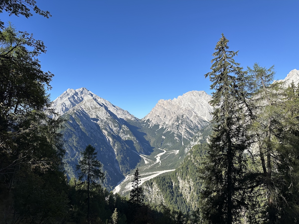
The ascent to Col Negro and Rifugio Chiggiato is in the woods, on a trail that’s almost always steep but comfortable. Nine hundred meters of elevation gain covered without stops, I felt in good shape. The fifteen-minute break I had planned at the refuge, I skipped it, a grave mistake. The presence of the two keepers having breakfast on the refuge terrace put me in a difficult situation. I didn’t want to sit there in their refuge without consuming anything, but I also didn’t want to move to the nearby meadow to avoid looking cheap. I had started just an hour and a half earlier, and it wasn’t the time to consume anything except maybe an energy bar, since the most challenging part awaited me.
Forcella Piccola as seen from the whereabouts of Rifugio Chiggiato. I will reach it on Day 3.
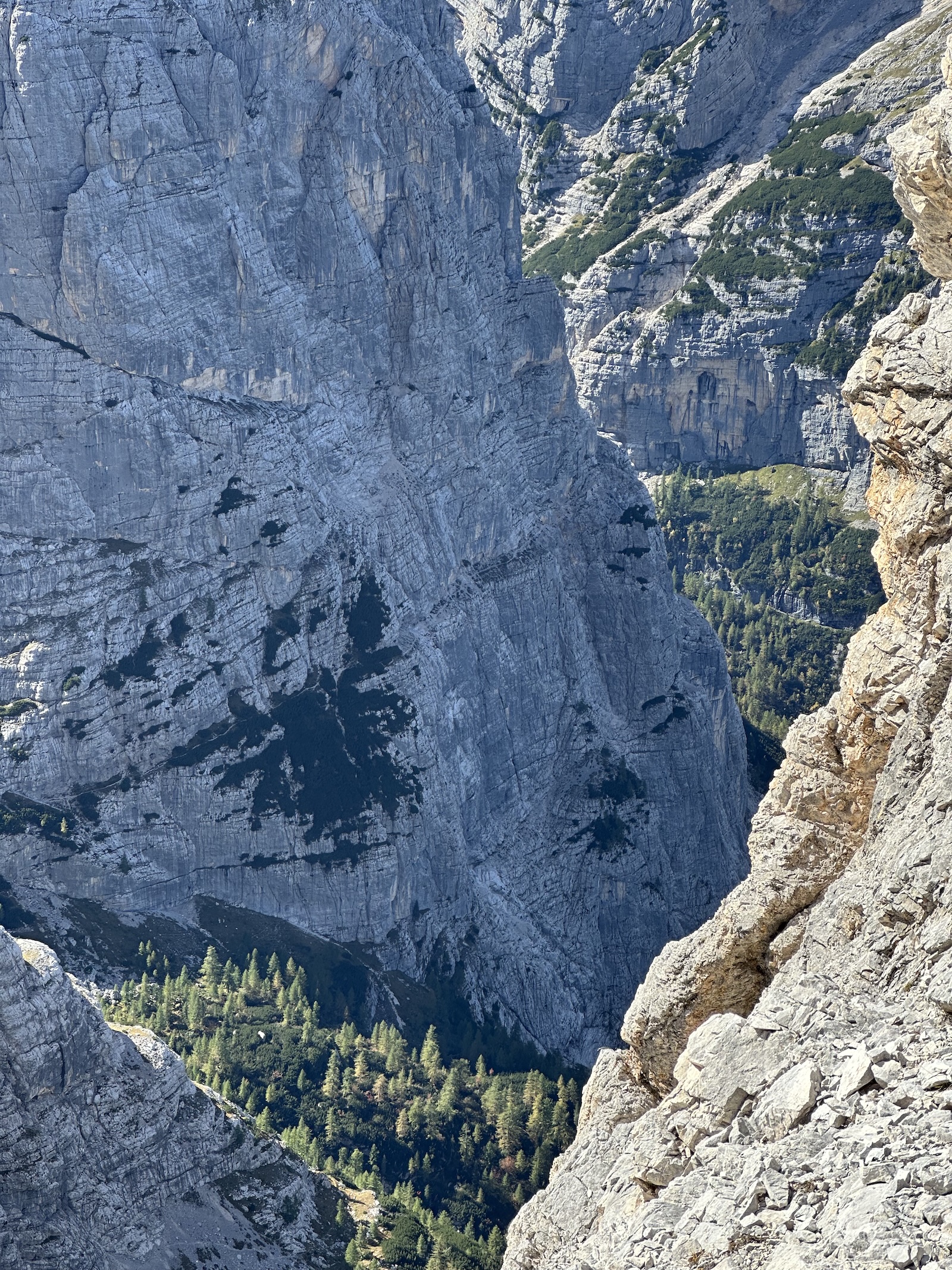
After a brief traverse westward, more or less at mid-slope toward Forcella Jau della Tana, the trail immediately becomes technical and demanding. It overcomes a series of rock “blades”) under Cima Salina, with deep intermediate scree gullies. It jumps on stones and scree, with continuous ups and downs. I slipped once on small rocks going downhill; fortunately, there was no damage apart from a couple of tears to my shorts. In this area, I encountered a herd of chamois moving nimbly, not too far on the opposite scree. There’s so much silence on these mountains that it’s easy to hear their alarm whistle or notice their trampling on gravel or rocks. Once I reached the vertical line to the pass, the final ascent began, a very long and largely steel-cabled route with exposed sections. This section, especially in the final part near the summit, really put me to the test. The two sections together (Parking-Rifugio Chiggiato, then Chiggiato-Jau della Tana) cover approximately 1,600 meters of elevation gain, which I stupidly tackled almost without rest. Toward the end, I was getting dizzy with every few steps and/or pulls on the iron cables. I was in difficulty and didn’t expect it, so much so that, now almost at the summit, I consumed a second energy bar. From Rifugio Chiggiato to Jau della Tana, it took me no less than two hours and thirty minutes, possibly three.
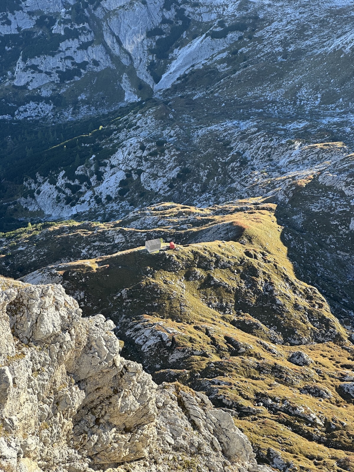
From the pass, I could see Bivacco Tiziano, the day’s destination. From up there, it appears as little more than a red dot still distant, resting on a grassy ridge a few kilometers away and about five hundred meters of elevation loss downhill. A few meters from the summit, I met the first person, a Frenchman (I think) with a tent and a huge backpack. He came from Bivacco Musatti or thereabouts and asked me where he could find some water. I told him it was a long way down until the Chiggiato; no water until there. While I was resting at the pass, a very young and fit boy reached me. He had stopped to chat with the Frenchman (I could hear them chatting a couple of hundred meters below me). The boy told me that the Frenchman left (if I understood correctly, I was tired) France in April and was slowly hiking across all the Alps to reach Slovenia by the end of October. Crazy. The boy was headed to Bivacco Fantoni and was the vanguard of a group of four. He was “running” ahead to arrive early at Fantoni, which nowadays is “YouTube famous” since it has been recently rebuilt and is now an ultra-modern and very comfortable structure. We parted ways as I undertook my descent toward Tiziano. Slowly, I descended first on steep scree and then on mixed terrain of stone and meadow, navigating the ups and downs of the Lastoni delle Marmarole, and finally arrived at Bivacco Tiziano at about 4:30 PM. Bivacco Tiziano is situated in a stunning location, at the western edge of the Lastoni, with the Marmarole ridges behind and the door opening onto the Ansiei Valley, a thousand meters below, and the Dolomites to the north. You can admire the Tre Cime di Lavaredo, Cristallo, the Tofane, the Cadini di Misurina, and many other well-known groups and peaks.
As widely expected, there’s no water at Tiziano, and none is found along the entire route once you leave Chiggiato. I had brought an extra supply that was sufficient to prepare dinner and breakfast for the next day, certainly not to continue for another two days. At this point, I was worried. In the bivouac log, a good soul had described where to find it. Still, it wasn’t close, and to be honest, for a moment I considered the idea of giving up and heading down to the valley the next day, so exhausted I was, and especially worried about the lack of water on the rest of the route. I had dinner, recovered some strength, and then, with my headlamp on, sat-nav in my pocket, and two water bottles in hand, I headed toward a wall of slabs “striped” by what looked like water rivulets. These slabs were approximately 500 meters from the bivouac as the crow flies, but to reach them, you had to cover a certain elevation difference, first uphill and then downhill. Without a backpack, however, it seemed like flying. Dinner had reinvigorated me, and I got there without too much suffering except for a frontal fall tripping on a stone that cost me a bruise on my hand that still hurts today. Reaching the wall, I realized that to collect water, it was necessary to climb about ten meters up the slabs, near a small roof from which water dripped onto the slabs below, forming the striped lines visible from the bivouac. Fortunately, the slabs are easily climbable due to their adhesion, so I went up and slowly filled one container at a time. It took a long time to fill the three containers from that tiny trickle of water; moreover, each time I had to climb down to return to the ground, deposit the whole container, and climb back up to fill the next one (I feared that a full water bottle could slip down and break). The position was uncomfortable: my feet were resting in adhesion, one hand to hold myself in place, the other with my arm extended to fill the bottle slowly. The entire procedure took me an hour, so I returned to the bivouac when it was almost dark. At 8 PM, exhausted but happy, I got into my sleeping bag and fell asleep almost immediately. For some strange reason, falling asleep alone, in a tent or bivouac, in such remote and wild places, far from everyone, with only nature around, puts me at ease. It’s almost as if I were cradled by nature itself.
Day 2
From Bivacco Tiziano to Bivacco Voltolina
The most spectacular day. I exit the bivouac and brush my teeth while a young ibex watches me, perplexed, no more than twenty meters away. Having left Bivacco Tiziano, I enter Val Longa, where three more ibexes, one adult and two youngsters, graze peacefully and are not at all intimidated by my passing by. The ascent begins early, though, on the hydrographic left of Val Longa, and it’s as I expected: steep and, soon, technical. Steel cable sections (not marked on the map) help in the most exposed sections until you reach the ridge line, in an airy and spectacular position, with breathtaking panoramas all around. Looking down in the direction I climbed from, I see the bivouac I left about an hour ago, a tiny red tin can. The path follows the ridge line until it reaches a pass that gives high entrance to a new glacial basin, the Meduce de Fora. We’re very high, literally a step from the sky. Far below, at the entrance to the upper part of the basin, I can see the red of Bivacco Musatti, the intermediate destination of the day. The descent is initially easy on the high meadows until I reach the terminal scree, which is initially steep and treacherous. Here, toward the bottom of the basin, I spot other ibexes a few meters from me. Unlike the cautious chamois, ibexes have a haughty attitude: they observe you calmly, unimpressed, with those majestic horns and regal pose. They certainly are the kings of the great heights. I find Bivacco Musatti occupied by a gentleman and his son. They are from the local CAI branch and are conducting maintenance work on the bivouac. I rest nearby for about ten minutes and leave again, aware that the longest and most demanding section still awaits me.
Bivacco Tiziano seen from the ridge line between Val Longa and Meduce de Fora. The brick building is the original bivouac, now abandoned.
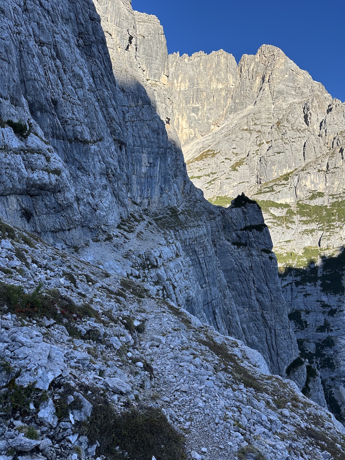
The ascent along the slopes of Monte Mecol is immediately hard and equipped with steel cables in the most exposed sections. Again, you climb up to the summit ridge and the highest passes; otherwise, you can’t get through. This is, it seems to me, the salient characteristic of these Marmarole Mountains: every valley change, on the north face, involves steep climbs, up to the summit ridges, then crossings of airy passes, and finally rough descents. There’s no easy passage from one basin to the other. The path descends and then crosses the Meduce De Inze among large erratic boulders. One must follow the many but constantly attention-requiring signs (red-painted dots and “ometti”); on this terrain, it’s easy to get lost. You then climb again, steeply and at length, again with equipped sections, on the slopes of Croda Rotta until arriving, you guessed it, at an airy pass. Staying high at the foot of the summit walls, you go around two or three gorges and cross again at length to finally drop, always on difficult terrain and often with the help of steel cables, to Forcella Vanedel, the narrowest, steepest, and also most dangerous of all. Pay attention here not to unhook too early from the cable: if toward the north the usual steep scree descends, toward the south, right where feet rest upon arrival, there’s a precipice of several tens of meters. Also be careful not to follow the scree downhill: a new steel cable is ready to your left and continues the course on the left slabs, still for a long time but gradually descending, parallel to the scree of Forcella Vanedel (still equipped sections here) until reaching a greener area and finally a trail that leads to the head of Val Granda, which is visible much lower, and to the access to Val De Medo, suspended almost in the void, where the day’s destination, Bivacco Voltolina, is hidden. A very exposed passage on rock protects access to Val De Medo. This passage is perfectly equipped with cables and is perhaps the most beautiful along the entire tour.
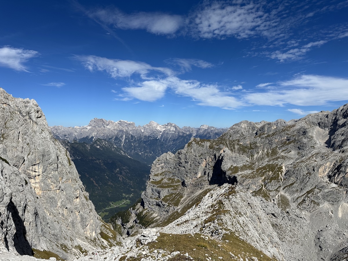
One of the many aerial views you are granted to enjoy on this high route.
Arriving in this valley hidden in the recesses of the Marmarole, no matter how tired, offers a magnificent sensation, also for the wonder of what opens before us. The bivouac can be seen in the distance, up high: one last effort to cover the last two to three hundred meters of elevation gain, and I can finally rest. I can already see that nobody is there: I will be alone for the night, once again. As the day before, I’m anxious about the water. I already imagine I’ll have to look for it among the walls surrounding the bivouac. The trail climbs through a low grove of larches (we’re at the extreme limit of the vegetation’s range), sometimes intersecting the dry bed of a stream, and sometimes running alongside it a hundred meters away. After a few hundred meters, I seem to hear the sound of flowing water. Where I am, you can no longer see the stream bed that was completely dry a few moments ago when I crossed it. I stand still for a moment listening: there’s no doubt, what I hear is water, and not little, flowing among the rocks. I leave the trail and head toward the sound. As I imagined, there’s an abundant water outcrop right in the stream bed, which, in this season, evidently, flows underground for most of the route. Enormous joy takes me. There’s a small waterfall, and there’s even a pool so big I could bathe in it. I drink all the water I have left, then fill the bottles, and all happy and watered, I cover the last kilometer that takes me to Voltolina. The conditions of this bivouac are worse than the previous one. There’s no broom, to begin with, which certainly doesn’t help keep it clean. There are no pillows, but there are mattresses and blankets, although partially eaten by critters. There’s the bivouac log, but a pen is missing to update it. I don’t have one with me, so I won’t be able to register my passage, which is a pity, also because I’ll probably be one of the last to pass here before winter. I don’t have to worry about water, so I can spend a couple of hours contemplating nature, taking in the majestic view that opens before me, and the silence at high altitude.
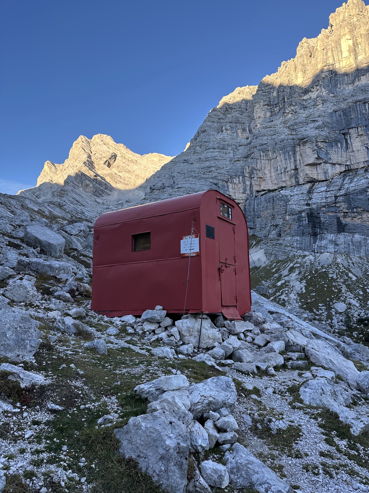
Bivacco Voltolina.
Day 3
From Bivacco Voltolina to Forcella Grande via Cengia del Doge, then to Forcella Piccola and return to Praciadelan, passing through Rifugi San Marco and Galassi
During the night, I was awakened by a loud crash, likely a landslide on the ridges behind or around the bivouac, possibly on the Piana del Scoter, which is located directly behind here. The descent from Voltolina is pleasant and enchanting, continuing until you arrive at the entrance to the famous Cengia del Doge. I hear the typical alarm whistle, I raise my head and see a group of chamois that, it seems to me, have just tackled the Cengia. The Cengia is about a kilometer of trail that exploits a very exposed ledge that cuts in half a very high vertical wall. Absence of vertigo and sure footing are required. It’s well secured with cables, except for a brief passage of about three meters, which, frankly, leaves me perplexed: it’s dangerous; a slip there would be fatal. From the Cengia, the gaze spans over the imposing slopes of Sorapiss opposite, beyond the deep and spectacular Val de San Vido. The Minazio Trail, which cuts horizontally across the southeastern spurs of Sorapiss, is clearly visible and is almost as stunning as the Cengia del Doge. I walked that trail nearly thirty years ago with Fabio (my brother) and Gianluca. Good memories. We were young.
The massive vertical wall traversed by the Cengia del Doge. Look closely and you’ll see a narrow path cutting almost horizontally through the wall.
The ledge exits into a trail that leads right to the head of Val De San Vido. Here you walk among larches and mountain pines (with some water!), passing under the famous Torre dei Sabbioni and finally reaching Forcella Grande. Here, the path abandons the wild north face of the Marmarole and descends toward Rifugio San Marco, which is managed and open in high season. When I pass, the managers are setting up for winter closure. I continue for Forcella Piccola, with a panorama over the valley of San Vito di Cadore and Monte Pelmo opposite. The path eventually crosses under the enormous south walls and then climbs to Forcella Piccola, where the Normal Route, which leads to the summit of Monte Antelao, begins. Many years ago, I was here in the same place on August 4 (!) to climb the Antelao summit, but I had to withdraw due to the snow that had fallen during a night storm. The climbs are over: from now on, only a long descent, passing from Rifugio Galassi on its last day of opening and continuing for six kilometers, first steep till Capanna degli Alpini, then four kilometers on Pian della Gravina until reaching the car again at Praciadelan and closing the loop.
Stepping onto Cengia del Doge.
I must admit that when I arrived at the car, I became emotional. The satisfaction of having completed this solo adventure, certainly the most demanding of all, filled me with joy. In terms of overall difficulty, the Translogorai comes close. Still, while in that case the difficulty is mainly due to its length, here on the Marmarole, it’s the combination of rugged and technical trails, difficult orientation, demanding elevation gains, exposed and un-equipped sections, lack of water, and isolation that raises the level.
Closing notes
While a GPX track is now standard procedure, it’s always a good idea to carry a good paper map, such as the Tabacco 016 for this hike. The GPX is valuable, but nothing beats the map when it comes to details, precision, and reliability. I ran out of battery on my phone on day two. It was fully charged when I left the bivouac. Still, always-on Komoot tracking can be taxing on the battery on very long days. I had a power bank with me, but the point still stands. A paper map is durable and, as such, always available.
An emergency satellite navigation device is mandatory for solo adventures, let alone one like this. I had no cell signal for three consecutive days. Yet every evening, when I arrived at the bivouac, I could text Serena to let her know I was doing fine. Moreover, in the unfortunate event of an emergency, help is just a press of the SOS button away.
Do your homework. Prepare consciously and adapt your usual routine to the expected situation. Knowing there was little water on the route, I brought an extra one-and-a-half-litre bottle with me. Best call ever.
Wait for the best weather. I had been waiting for the perfect long weekend for one month. I only went when the forecast was highly optimistic. Knowing that the weather is not an issue is a significant relief and a crucial safety measure, especially on hazardous and challenging terrain.
I could go on a super sunny weekend because we were almost in the Fall. Going off-season is beneficial for many reasons, one of which is that it’s not scorching hot weather. Also, you can expect very little company on the route and, more importantly, at the bivouacs. The room in those shelters is minimal. Being alone in both of them was a luxury, but a planned one.
The GPX is I used is available here. This is not the effective recording because well, my phone died at some point, as mentioned.